Mangrove Forest
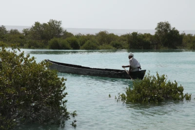
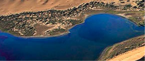
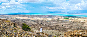
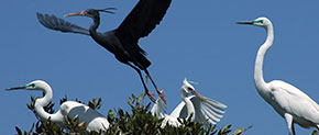
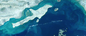
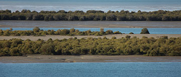
The mangrove marine forest, which is one of the World's Biosphere Reserves, with an area of about 9,000 hectares, is the largest collection of marine forests located in the Persian Gulf. The vast and muddy bed of the sea, as well as the mangroves of the Avicennia Marina species, host numerous species of fish, amphibians, and migratory or native birds. Among those are endangered species under IUCN protection. In addition to being on the Biosphere Reserve List, the area is also listed in the UNESCO Man and the Biosphere Program, as well as on the Ramsar Convention List of protected areas. Many residents of the villages around the mangrove forest are directly involved in ecotourism activities in the region. That is why Qeshm Global Geopark implements an ongoing and long-term program for the local community around mangroves for conservation and sustainable exploitation. The mangrove is a saltwater tree that is submerged at high tide, and with water treatment and purifying features embedded in its roots, it repels sea salt and absorbs the treated water. The expansion and development of natural mangroves on Qeshm Island are confined to the Khoran Seaway and the north coast of the island. The extent of mud areas on the northern coasts is broader than on the southern shores, which this factor weakens tidal intensity and reduces wave turbulence. Geological factors play an important role in the formation of the Khoran Seaway. The Laft headland that caused the transversal elongation of the island, is the result of the formation and elevation of the Gevarzin anticline. The Gevarzin anticline is nearly based on the N-S process, and this process is exactly the opposite of the general process of anticlines in the region. The region’s anticlines are almost based on the SWWNE process. According to the studies, the formation of this anticline is affected by a hidden salt dome that had no opportunity to appear. However, its elevation and performance have been observed in seismic reports. In the last 100,000 years, the Persian Gulf has come out of the water several times, and the latest seawater advance and the formation of the Persian Gulf in its present form dates back 20,000 years. Due to the proximity of the Mehran River and the Coal River deltas, the mud sediments of mangrove forests are supplied through these deltas. The study of heavy minerals in the mangrove forest floor and comparing it with the sediments of Qeshm and Khamir coasts increases our knowledge about the sedimentation processes of the region. The low intensity of the tidal fluctuations in the Khoran Seaway is due to the hidden salt dome that has led to the rise of the Gevarzin anticline and formed the Laft headland. The process of this anticline has led to the formation of a marine harbor to break the strength of the sea waves and create a calm environment. This peaceful environment and other environmental conditions have caused the mangrove forests to adapt and permanent.
Related downloads
Where Mangrove Forest geosite is located ?


