Awli Gorge
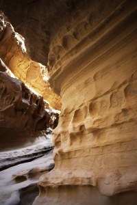
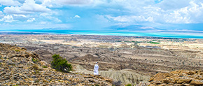
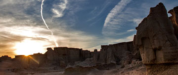
In the west of Qeshm Island and the northern edge of Salakh anticline, there are several narrow and long parallel valleys in the sandstone and marl body of Aghajari formation, which has created a unique landscape. Awli Gorge is a canyon valley formed as a result of developing linear and lateral tensile joints of the Salakh anticline. The main entrance of the valley is created by the rupture of the lateral fissure perpendicular to the axis of the anticline. In this valley, marl, limestone, and sandstone layers are regularly layered and erupted with small thicknesses up to big masses in which various types of erosion can be seen. Dissolution and water erosion are shaped very beautiful forms of small and large dissolution grooves, pigeonholes (Tafoni), and natural wells. The concave cavities and recessions of the walls in this gorge have created a picturesque and amazing view. These forms are shaped as the result of flood currents that overrun the valley on rainy days. We also see the formation of crenate walls that are created in two steps. In the first step, during heavy rains, a thick-washed stream of mud from the upper floors flows downwards in the form of a gutter and covers some parts of the wall of the lower floors. It covers the lower rock layers after drying as a mortar and protects it from further erosion. The spectacular and amazing walls of Awli Gorge have a high aesthetic value which is highly important to protect them from any damage. These walls have created a unique and wonderful perspective, especially for those who are interested in sightseeing and photography.
Related downloads
Where Awli Gorge geosite is located ?


